Behind the scenes · · 4 min read
Malta just got bigger: Dingli, the south coast and Marsaskala
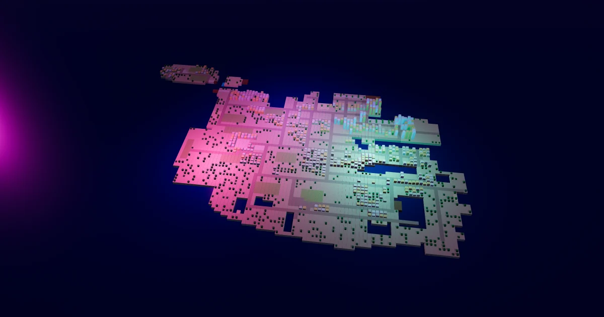
The island in Malta Living just grew: a bigger map in a life sim that was already full. There's 42% more land than yesterday, from the Dingli cliffs in the west to Delimara in the far south-east, and room to breathe in St Julian's and Sliema. Nothing you had moved, no trip costs a cent more, and the map is lighter on your phone than it was before. Here's what's new, and how we made a bigger island cheaper to draw.
Where the new land is
The west coast. The Middle now runs out to the Dingli cliffs, the highest on the island (Dingli Cliffs drop about 250 metres to the sea). A new road runs from Dingli to Rabat's road, through fields and open country west of Siġġiewi.
The south coast. Below Siġġiewi and Qrendi there's now a real coastline: a road down to the cove at Għar Lapsi, a coast road along the cliffs, the inlet at Wied iż-Żurrieq where the boats leave for the Blue Grotto, and the sand of Pretty Bay at Birżebbuġa.
The east coast. Past Żejtun the road carries on to Marsaskala, with its creek and fishing harbour, St Thomas Bay's shallow water, and a road down the Delimara peninsula to the rock ledges of St Peter's Pool. Marsaxlokk's bay opens a little wider on the way.
St Julian's and Sliema. St Julian's grows north: the St George's Bay front, with a road and a seafront walk, Pembroke beyond it, and towers round Portomaso's marina. Sliema grows east at Tigné, with a new road, and Manoel Island sits in Marsamxett harbour. These were the most crowded corners of the map; the strip in Paceville stays where it was, with space round it now.
Every new road joins the island's roads, so you can walk or drive anywhere on it. Gozo and Comino haven't changed.
What stays the same
No place moved. Your home, your furniture, every place's card and every link to a place stay exactly where they were. Fares don't change either: trips are priced from where each place stands on the game's road map, so a ride from Valletta to Mosta costs what it did yesterday. (How fares and prices work is in real places, real prices.)
Three plots of open ground are kept empty: one at Pembroke, one at Tigné and one at Mtaħleb. Nothing grows or gets built on them, so they're there when they're needed.
A bigger island, lighter on your phone
Until today the map drew every house, tree and piece of road on the island in every picture, even the ones far off the edge of your screen. On a phone that adds up: about 1.3 million triangles a picture, wherever you looked.
Now the map draws its houses, trees and roads only in a window round what you can see, a couple of cells wider than the screen so nothing pops in at the edge, and it moves that window in steps as you pan. The further out you zoom, the more it draws; at the normal zoom it draws your part of the island. We measured each area on a phone-sized screen before and after:
- at the normal zoom, a picture fell from about 1.3 million triangles to between 0.17 and 0.56 million, in every area;
- draw calls, the number of separate jobs the phone's graphics chip gets each picture, fell a little in every area;
- zoomed as far out as the map goes, with 42% more island, it draws about half the triangles the old, smaller map did.
So the map is bigger, and asks less of your phone's graphics.
Go and look
Play Malta Living free in your browser, open the Map, and drag it west to Dingli, south along the coast, or east to Marsaskala. New to the game? Start with what Malta Living is, or read about the Il-Magħluq waterfront on the way past Marsaxlokk.
Questions people ask
Did any place or home move on the bigger map?
No. Every place, home and billboard is on the same cell as before. The new land was added round the old island, east and south of its old edge.
Do trips cost more now that the map is bigger?
No. Fares are worked out from where places stand on the game's road map, which didn't change, so every trip between places costs and takes what it did.
Why is the map lighter on my phone?
It now draws houses, trees and roads only round what's on your screen, instead of the whole island in every picture. At the normal zoom that's well under half of what it drew before.
Is Gozo bigger too?
No, Gozo and Comino are as they were. The new land is all on Malta: the west, south and east coasts, St Julian's and Sliema.